

Table Rocks; History and Hiking
By Heather Headley
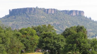
There are many theories on how the Table Rocks were formed. The latest of these theories is a shield volcanic eruption near Prospect, Oregon that spread lava approximately 44 miles to Sam’s Valley, Oregon. It caused the Rogue Valley to rise in elevation to the height of the Table Rocks. Then the Rogue River slowly eroded around the Table Rocks and left them standing. Both Lower and Upper Table Rocks are U-shaped theoretically because the river made sharp bends at each mesa. Both Upper and Lower Table Rock make for a nice hike.
Upper Table Rock
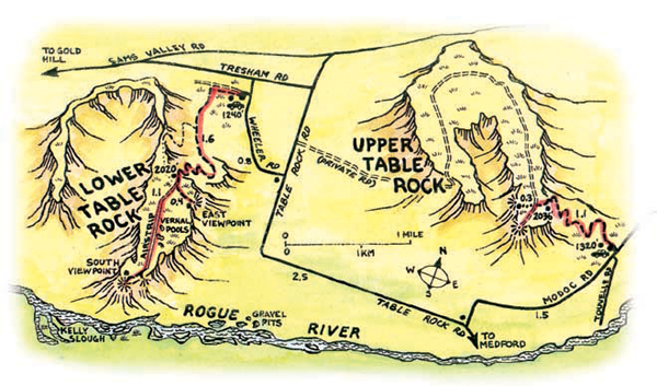
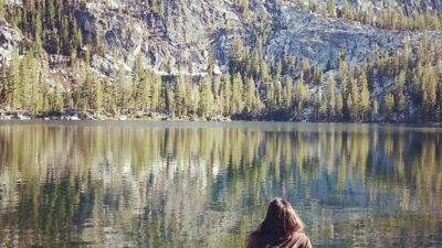
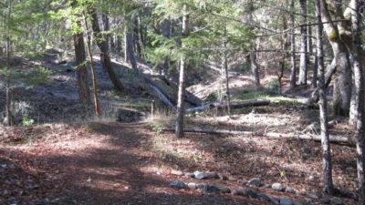
Upper Table Rock is a 1.25 mile easy to moderate level hiking trail. The trip takes approximately 3 hours round trip. It gains 720 feet in elevation as it meanders through unique monoliths from the original lava flow, and contains a few steep sections. This trail is recommended for first time or novice hikers. On a clear day you can see the entire Rogue Valley, Mt. Ashland, Mt. McLoughlin, and Pilot Rock.
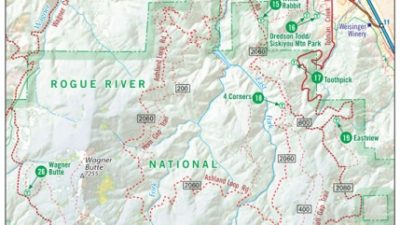
Directions from Ashland, Exit 19 (most northern exit): Drive 14 miles north to Central Point Exit 33. Drive east on Biddle Road 1 mile. Turn left on Table Rock Road for 5.2 miles to a curve, and turn right on Modoc Road for 1.5 miles to the trailhead parking lot on the left, just opposite Fraley electric substation.
Lower Table Rock
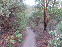
Lower Table Rock is a 1.75 mile moderate level hiking trail. The trip takes approximately 4 hours round trip. It gains 780 feet in elevation as you ascend to an old abandoned airstrip. If you choose to hike the airstrip you can add an extra mile to your trip. During the wet season (October through May) you will notice vernal pools in the low lying areas at the end of the airstrip. These pools host the protected Fairy Shrimp and are surrounded by an endangered endemic (only found on the Table Rocks) plant called the Dwarf Wooly Meadowfoam. Although the trail is more steep and rocky, you do have the luxury of hiking through shaded woods.
Directions from Exit 19 (most northern exit): Drive 14 miles north to Central Point Exit 33. Turn right onto Biddle Road and drive east for 1 mile. Turns left on Table Rock Road to milepost 10, and then turn left on Wheeler Road 0.8 miles to Lower Table Rock.
Dogs, horses, bicycles and motor vehicles are not allowed on either trail to avoid disturbing ground nesting birds and other animals. Beware of the Triple Leafed Poison Oak. It lines both trails and is a reddish color in the spring. Please do not pick the flowers so that others may enjoy them. You will want to bring water as there is none provided. There are outhouses provided at both trailheads.
Both trails are both opened year round. In the spring, beginning in March, the Bureau of Land Management offers guided hiking trips led by local volunteer specialists. You can make a reservation by calling the BLM at 541-618-2200.
Comments
No comment yet.